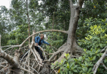
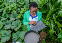
Illustrative Image: Why South Africa’s Land Is Rising: Scientists Link Uplift to Drought and Climate Change
Image Source & Credit: Tobias Fischer / Unsplash
Ownership and Usage Policy
South Africa’s Soils Are Rising—And Scientists Now Understand Why
In an intriguing twist of nature, recent geophysical studies have confirmed that South Africa’s landmass is slowly but steadily rising above sea level. From 2012 to 2020, scientists recorded an uplift of around 6 millimeters—a subtle but significant change. This phenomenon, tracked through a network of high-precision GPS receivers across the country, had puzzled geologists for years. Now, new research suggests that the cause lies not deep within the Earth, but in the climate above it.
Drought: The Unseen Force Lifting the Land
According to a study led by researchers at Germany’s University of Bonn, published in the Journal of Geophysical Research, the culprit behind the rising ground is prolonged drought. Using a combination of ground-based GPS data and satellite imaging, the team established a strong correlation between regional water loss and land uplift.
The mechanism is rooted in fundamental physics: water adds weight to the Earth’s crust. When significant amounts of water—whether from rain, rivers, groundwater, or soil moisture—are lost during droughts, the pressure on the Earth’s surface decreases. In response, the crust rebounds upward, much like a sponge decompressing after being squeezed.
To trace this phenomenon, researchers analyzed historical precipitation patterns and combined them with data from the GRACE satellite, which measures variations in Earth’s gravitational field. GRACE is particularly adept at detecting changes in underground water storage. The results showed that areas suffering from severe water depletion experienced the most pronounced land uplift.
“By monitoring variations in total water storage—which includes surface water, soil moisture, and groundwater—we’re able to observe how water mass loss influences Earth’s surface,” explained Dr. Christian Mielke from the German Institute for Geodesy and Geoinformation. In essence, less water means less weight, and less weight means the land can subtly lift.
Climate Change: A Hidden Sculptor of Landscapes
South Africa is no stranger to drought. The nation regularly experiences extended dry periods, with the 2018 Cape Town water crisis—dubbed “Day Zero”—serving as a stark reminder of its vulnerability. As climate change accelerates, such events are becoming more frequent and intense, reshaping not only the environment but the very land beneath our feet.
The United Nations warns that Africa is warming faster than the global average, despite contributing only about 4% of global greenhouse gas emissions. This makes the continent disproportionately susceptible to climate-driven disruptions, including these unexpected geological shifts.
Interestingly, earlier hypotheses attributed South Africa’s land uplift to deep-earth geological activity—specifically, a mantle plume, where superheated rock rises toward the surface. While such plumes can indeed elevate crustal regions, the new drought-centered findings present a more immediate and climate-relevant explanation.
Implications for Infrastructure, Ecology, and Planetary Science
The consequences of this slow uplift extend far beyond academic curiosity. Changes in land elevation—even at the millimeter scale—can alter water drainage patterns, disrupt agricultural systems, affect building foundations, and shift ecosystem balances.
For example, rising land in a river basin might cause water to flow differently, potentially leading to localized flooding or soil erosion. Similarly, structural engineers may need to consider these micro-level movements when designing long-term infrastructure, especially in water-stressed regions.
On a broader scale, the precision of GPS and satellite technologies—many initially developed for astronomy—now enables us to detect and analyze these terrestrial changes with unprecedented accuracy. These insights can help policymakers improve water resource management, guide urban planning, and build resilience against the hidden impacts of climate change.
Moreover, studying the Earth’s response to water loss may provide analogues for other planets. Understanding how mass redistribution affects planetary crusts could enhance our interpretations of Martian topography or the icy moons of Jupiter and Saturn, where similar rebound mechanisms may occur.
A Subtle Yet Profound Reminder
While much of the public’s attention is drawn to dramatic climate events—raging wildfires, devastating hurricanes, or shrinking glaciers—this gradual geological rise in South Africa highlights a quieter, subtler transformation. It reminds us that climate change doesn’t just influence weather—it’s reshaping the planet itself.
South Africa, with its intricate blend of climatic vulnerability and cutting-edge geophysical monitoring, is emerging as a natural laboratory for exploring the deep links between climate, geology, and planetary dynamics. As researchers continue to unlock the stories written in the land, we are reminded that even the ground beneath our feet is not immune to the consequences of a changing world.


 The African Research (AR) Index is a comprehensive scholarly directory and database focused explicitly on journal publishers that publish and disseminate African research.


it is fascinating to see how land uplift in South Africa is being directly linked to drought and groundwater depletion. It’s a powerful reminder of how climate change not only affects weather patterns but also reshapes the land beneath us. This research underscores the urgent need for sustainable water use and more equitable resource management.