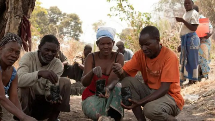
A recent study by Egbebike et al. (2024) titled “REMOTE SENSING APPLICATIONS IN MAPPING RISKS ASSOCIATED WITH CLIMATE CRISIS, RESILIENCE, AND HUMANITARIAN RESPONSE: THE AFRICAN PERSPECTIVE” published in Nnamdi Azikiwe University Journal of Civil Engineering (NAUJCVE) shows that remote sensing technologies, such as NDVI and SAR, were highly effective in mapping climate-related risks like droughts and floods.
“
Remote sensing technologies effectively map climate risks, enhance disaster response, support resilience, and improve climate adaptation strategies in Africa. – Egbebike et al. 2024
This study investigates how remote sensing technology can address the challenges posed by the climate crisis in Africa. It highlights the use of remote sensing in mapping climate-related risks such as droughts and floods, enhancing resilience through early warning systems, and supporting sustainable resource management. The research emphasizes the critical role of remote sensing in humanitarian response efforts, including damage assessment and coordination of relief operations after climate-induced disasters. Key tools and technologies discussed include the Normalized Difference Vegetation Index (NDVI) and the Soil Moisture Active Passive (SMAP) mission, which are used to monitor and predict drought conditions. Additionally, Synthetic Aperture Radar (SAR) and high-resolution optical imagery are employed to monitor and evaluate the impacts of floods, detect drought stress in vegetation, and track surface temperature changes. Data from MODIS sensors on NASA’s Terra and Aqua satellites has been instrumental in monitoring droughts and forecasting crop failures. The study also references the pivotal role of remote sensing during Cyclone Idai in 2019, where it provided rapid damage assessments that supported the humanitarian response. However, challenges such as limited access to high-resolution data and inadequate infrastructure hinder its broader application. The research underscores the importance of building local capacity through training and education to maximize the benefits of remote sensing technology.
How the Study was Conducted
High-resolution satellite images from sources like MODIS, Landsat, and Sentinel were used to gather data on various environmental parameters. Field data were also employed to validate and calibrate the satellite data, ensuring accuracy and reliability. The authors also employed Normalized Difference Vegetation Index (NDVI) to monitor vegetation health and detect drought conditions as well as Soil Moisture Active Passive (SMAP) which aimed to provided data on soil moisture levels, crucial for drought prediction and monitoring. Synthetic Aperture Radar (SAR) also employed for flood monitoring, as it can penetrate cloud cover and provide high-resolution images even in adverse weather conditions. In addition, Thermal Infrared Imaging (TIR) were used to detect drought stress in vegetation by measuring surface temperatures. The authors used Geographic Information Systems (GIS) to analyze spatial data and create risk maps. Time-series analysis was conducted to monitor changes over time and identify trends in climate-related risks.
What the Authors Found
The authors found that remote sensing technologies, such as NDVI and SAR, were highly effective in mapping climate-related risks like droughts and floods. These tools provided critical data for early warning systems and disaster preparedness. Remote sensing played a crucial role in humanitarian response efforts. High-resolution satellite imagery was instrumental in assessing damage and coordinating relief efforts during climate-induced disasters, such as floods and cyclones.
Why is this important?
Addressing Climate Vulnerability: Africa is highly susceptible to the impacts of climate change, including severe weather events, prolonged droughts, and shifting agricultural zones. This study provides valuable insights into how remote sensing can help mitigate these risks by offering accurate and timely data for early warning systems and disaster preparedness.
Enhancing Resilience: By leveraging remote sensing technologies, the study highlights ways to enhance the resilience of communities against climate impacts. This includes sustainable resource management and improved disaster response capabilities.
Supporting Humanitarian Efforts: Remote sensing plays a critical role in humanitarian response efforts by providing rapid damage assessments and guiding relief operations during climate-induced disasters. This can significantly improve the efficiency and effectiveness of aid distribution and recovery efforts.
Technological Advancements: The study showcases the potential of advanced remote sensing technologies, such as Synthetic Aperture Radar (SAR) and Thermal Infrared Imaging (TIR), in monitoring and managing climate-related risks. These technologies offer high-resolution data that can be crucial for detailed analysis and decision-making.
Capacity Building and Local Expertise: Emphasizing the need for capacity building, the study underscores the importance of training and education in maximizing the benefits of remote sensing technologies. This can empower local communities and institutions to better manage and respond to climate challenges.
Policy and decision-making: The findings of the study can inform policy and decision-making processes by providing evidence-based insights into the effectiveness of remote sensing applications. This can lead to more informed and strategic approaches to climate adaptation and mitigation.
What the Authors Recommended
- The authors advocate improving access to high-resolution remote sensing data for African countries. This includes making satellite imagery more affordable and readily available to local institutions and governments.
- The study emphasizes investing in training and education programs to build local expertise in remote sensing technologies. This will empower communities and institutions to effectively use remote sensing data for climate risk management and resilience building.
- The authors ought Africans to develop and improve the infrastructure needed to process and analyze remote sensing data. This includes investing in advanced computing facilities and software tools that can handle large datasets.
- The study also advocates fostering collaboration between international organizations, governments, and the private sector to support the implementation of remote sensing technologies. Partnerships can help share resources, knowledge, and best practices.
- Integrate remote sensing data into national and regional policies for climate adaptation and disaster risk management. This will ensure that decision-makers have access to accurate and timely information for planning and response.
- Promote the use of remote sensing for sustainable resource management. This includes monitoring land use changes, deforestation, and water resources to support conservation efforts and sustainable development.
- In addition, enhance early warning systems for climate-related hazards by incorporating remote sensing data. This will improve the accuracy and timeliness of warnings, helping communities prepare for and respond to disasters more effectively.
In conclusion, the study by Egbebike et al. (2024) underscores the transformative potential of remote sensing technologies in addressing the multifaceted challenges of the climate crisis in Africa. By providing critical data for early warning systems, disaster response, and sustainable resource management, these tools offer actionable solutions to enhance resilience and mitigate risks. However, unlocking their full potential requires addressing challenges like data accessibility, infrastructure development, and capacity building. Collaborative efforts among governments, institutions, and international partners are essential to leverage these technologies for a sustainable and climate-resilient future across the continent.






 The African Research (AR) Index is a comprehensive scholarly directory and database focused explicitly on journal publishers that publish and disseminate African research.